General contractors
Visual documentation for owner reports, pay applications, and schedule updates, without sending someone up a lift.
Bluff City Aerial / Construction progress
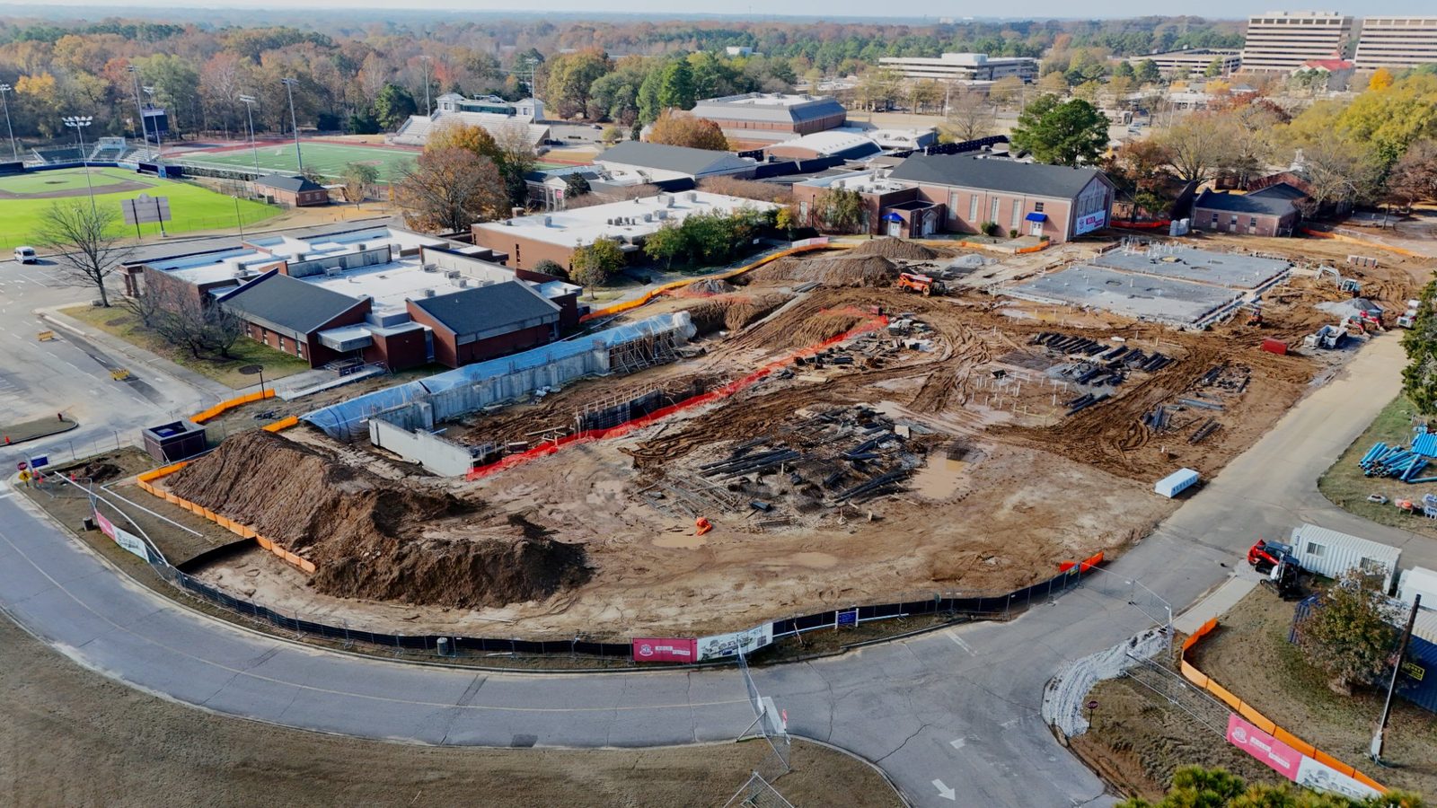
Monthly aerial photos from the same positions, heights, and angles, so owners, lenders, and project teams can see exactly what changed since the last flight.
Progress photos are only useful if you can compare them. On the first visit we record every launch point, altitude, heading, and camera angle. Each later flight repeats them, so this month's overview lines up with last month's and the change is obvious at a glance.
That consistency is hard to get from a rotating pool of pilots. At Bluff City Aerial, the owner flies every visit, so the shot plan, the site knowledge, and the relationship with your superintendent stay the same from groundbreaking to completion.
Visual documentation for owner reports, pay applications, and schedule updates, without sending someone up a lift.
See the whole site from above every month, even when you are managing it from another city.
A consistent visual record to accompany draw reviews and project updates.
A progress archive and finished-project aerials for proposals, awards submissions, and portfolios.
Send the address and schedule. We check the airspace, set the shot list, and record fixed positions on the first flight.
Monthly flights, milestone flights, or both. Weather days are rescheduled to the next clear morning.
Check in with the superintendent, fly the plan, and deliver edited photos within 48 hours.
A completion set and a first-to-last comparison sequence for the project file.
Every flight is flown by an FAA Part 107 certified drone pilot and carries $1 million in liability coverage. Certificates naming the general contractor, owner, or lender as additional insured are provided before the first flight.
Flight paths are planned to stay clear of crews working on site. For sites in controlled airspace near Memphis International or other airports, FAA airspace authorization is requested before every flight.
Monthly is the most common schedule. Many projects add flights at milestones such as site work, foundations, vertical construction, dry-in, and completion. The schedule is set with you before the first flight.
On the first visit we record the launch points, altitudes, headings, and camera angles for each shot. Every later flight repeats those positions, so each month's photos line up with the last.
FAA Part 107 limits flying directly over people. Flight paths are planned to stay clear of crews, and we check in with the site superintendent before every flight.
Progress work is priced per flight, with program pricing for recurring monthly schedules. Call or text 901-497-5656 with the site address and schedule for a same-day quote.
The site address, a superintendent or project manager contact, any site safety rules, and your certificate of insurance requirements. We handle the flight planning and any airspace authorization.
Edited photos are delivered within 48 hours through a download link, labeled by flight date so they can drop straight into owner reports and pay applications.
Send the site address and your schedule. You'll get a shot plan and a quote the same day. Call or text Forrest directly.