Land and investment brokers
Large tracts and development sites where the boundary, access, and location need to be understood in one viewing. See land listings with boundary overlays.
Bluff City Aerial / Drone video
Edited 4K aerial video, 60 to 90 seconds, with titles and motion-tracked boundary lines. 6K capture and master files are available for architects and developers.
Land, retail, office, and campus projects around Memphis. More on the Bluff City Aerial YouTube channel.
 Highway 51 LandCommand Realty, land listing with boundary overlays
 Shops on Goodman RoadCommand Realty, retail center
 Memphis University SchoolThe Crump Firm, architecture
 3915 MendenhallNAI Saig, business park commercial building
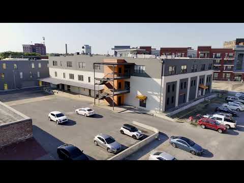 460 Tennessee StreetDowntown Memphis property
 Presbyterian Day SchoolThe Crump Firm, architecture
 Bluff City Aerial SamplerMemphis highlights
Video shows how a site sits in its surroundings: the approach from the main road, the distance to the interchange, the neighbors on each side. For large tracts and development sites, a boundary line that stays locked to the ground as the camera moves makes the parcel readable in a way a still image can't.
Every video package includes edited aerial stills, so one flight covers the listing photos and the video.
Large tracts and development sites where the boundary, access, and location need to be understood in one viewing. See land listings with boundary overlays.
Retail centers, business parks, and industrial assets shown in the context of their corridor. See commercial real estate drone photography.
Finished-project and campus video for portfolios, awards submissions, and proposals.
Short flyovers for owner updates, added to a construction progress schedule.
Text or email the property address, the acreage, and what the video needs to show.
You receive an airspace check, a shot plan, a fixed price, and a delivery date.
Flights are timed for the best light, with launch points planned around trees and terrain.
The edited video and stills arrive by download link. Two rounds of revisions are included.
Most property videos run 60 to 90 seconds, long enough to show the site and its surroundings and short enough to hold a buyer's attention.
Video delivery dates are confirmed when you book, because editing time depends on the project. Edited photos from the same flight are typically delivered within 48 hours.
Yes. Motion-tracked boundary lines stay on the parcel as the camera moves. The outline is a marketing graphic drawn from county parcel data or your survey, not a legal survey.
4K is the standard and suits listings, websites, and presentations. 6K capture records more detail, which gives architects, developers, and editors room to crop and reframe. 6K master files are available on request.
Yes. Unedited footage can be delivered for teams that have their own editor.
Every job gets a fixed quote the same day, based on the property and what you need. Call or text 901-497-5656 with the address.
Send the property address and what the video needs to show. You'll get a shot plan, a fixed price, and a delivery date. Call or text Forrest directly.