Heavily wooded tracts
Shots are flown from outside the tract at the far corners, where distance shows more of the property than altitude can. Leaf-off season, from November on, opens up creeks and road lines.
Bluff City Aerial / Land and boundary overlays
Show buyers exactly what is for sale. Aerial photos of raw land and development sites with the parcel boundary drawn in and the roads, interchanges, and landmarks around it labeled.
From the road, most land listings are a tree line and a sign. Buyers and developers want to know where the property starts and stops, how much frontage it has, how it is accessed, and what is nearby. A boundary overlay answers all of that in one image.
The parcel outline is drawn from county parcel data or the survey or plat you provide, then aligned to the aerial photo. Roads, interchanges, schools, neighborhoods, and new development are labeled so the location sells itself, whether the buyer is local or reviewing the listing from another state.
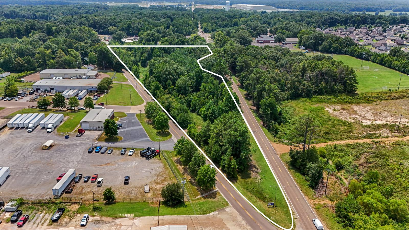
Shots are flown from outside the tract at the far corners, where distance shows more of the property than altitude can. Leaf-off season, from November on, opens up creeks and road lines.
Stitched wide-angle panoramas from near the 400-foot limit capture large tracts in a single frame, with a road in every hero shot for orientation.
Only the parcels you are marketing are outlined, even when an owner's other tracts sit next door.
Overlays highlight access, utilities corridors, nearby rooftops, and traffic generators that developers look for first.
The address or parcel ID, the acreage, and a survey or plat if you have one.
An airspace check, the camera stations, the labels to show, and a fixed price the same day.
Flown in the best light from launch points planned around trees and terrain.
Hero overlays and context stills by download link, ready for the listing.
Land and investment brokers marketing raw land, pad sites, and development tracts. Developers and owners presenting a site to partners or lenders. Estates and family owners selling acreage that is hard to show from the road.
Every flight is flown by an FAA Part 107 certified drone pilot with $1 million in liability coverage. Certificates naming the broker or owner as additional insured are available at booking.
The outline is drawn from county parcel data or the survey or plat you provide and aligned to the photo using the drone's GPS position, heading, and camera angle. It is a marketing graphic that shows buyers the property's shape and location, not a legal survey.
Yes. Wooded tracts are shot from outside the property at the far corners, where distance shows more of the land than altitude can, and stitched panoramas capture large tracts in one frame. Leaf-off season, from November on, shows creeks and road lines more clearly.
FAA Part 107 limits flights to 400 feet above the ground in most airspace. For large tracts, wide panoramas from near that height show more of the property than a single photo.
The address or parcel ID, the acreage, a survey or plat if you have one, the landmarks or roads you want labeled, and your listing deadline.
Yes. Land and development videos can include motion-tracked boundary lines that stay on the parcel as the camera moves. 6K capture is available for large projects.
Edited photos and boundary overlays are delivered within 48 hours of the flight. Video delivery dates are confirmed when you book. Call or text 901-497-5656 for a quote.
Send the address or parcel ID and the acreage. You'll get a shot plan and a fixed price the same day. Call or text Forrest directly.